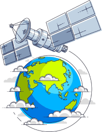
Satellite Imagery and Remote Sensing Data
Continuously viewing Earth from satellites extends to observation of the Earth's surface, oceans, and atmosphere. The images and measurements made available from these vehicles allow scientists to monitor hurricanes, wildfires, ice loss, and urban sprawl. With their data support, remote sensing is critical to disaster readiness, environmental preservation, agriculture, and other aspects of the long-term climate studies.
The following are some of the well-recognized satellite data programs and platforms used by a vast number of Stellar Missions and the Collection of Light. Though they vary slightly in the purpose of use, they join hands in forming the backbone of modern Earth observation.
NASA Earth Observations
NASA’s Earth Observing System provides a wide range of imagery and environmental measurements. Its satellite missions monitor temperature, clouds, atmospheric gases, vegetation health, and ocean color. Platforms such as MODIS and VIIRS generate near-daily global coverage, which is essential for tracking natural hazards and long-term environmental change.
Students and educators often use NASA datasets to visualize global phenomena such as dust transport across continents or seasonal shifts in vegetation. The data is designed to be publicly accessible, reinforcing transparency and scientific collaboration. For researchers, the system offers high-resolution products suitable for modeling and analysis.
USGS Landsat Program
The United States Geological Survey, in partnership with NASA, operates the Landsat satellite series. Landsat has provided continuous Earth imagery since 1972, making it one of the longest-running satellite programs in the world. This historical archive allows scientists to compare landscapes over decades.
Landsat data is widely used for mapping deforestation, tracking coastal erosion, monitoring crop production, and studying urban expansion. Because the imagery is standardized and consistent over time, it supports careful scientific comparison and responsible land management planning.
European Copernicus Program
The Copernicus Programme, coordinated by the European Union, operates Sentinel satellites that monitor land, oceans, and the atmosphere. Sentinel missions provide radar and optical imagery, which can capture data even through cloud cover. This is especially useful for flood monitoring and rapid disaster response.
Copernicus also delivers climate services and air quality monitoring tools. The program emphasizes open data access and supports policy development across Europe and beyond. Its datasets are frequently used in environmental regulation, climate adaptation strategies, and cross-border scientific research.
Interactive Mapping and Exploration Tools
User-friendly discovery tools can foster the easy accesing of data even by non-technical users. People can visually check on how the environment is changing, by comparing data, without requiring an advanced understanding of technology, or they can zoom in on satellite images for viewing in interactive platforms.
NASA Worldview
A highly interactive tool that offers satellite image analyses based on data from NASA missions, NASA Worldview, takes into consideration multiple-layer data overlays like aerosol levels, sea surface temperatures, and wildfire hotspots.
This tool bridges the gap between raw satellite measurements and visual interpretation. It enables students and the public to see global environmental events as they unfold, reinforcing awareness and understanding.
Google Earth
Google Earth is a platform with an intelligent interface to explore its high-resolution images and three-dimensional terrain models. This software aptly trained users in questioning the landscape, measuring distances, and exploring the past imagery for changes over time.
Geography teachers frequently use this program for teaching purposes. Planners use the picture as a reference for research. Hence, it presents an interesting realm to start exploring in geospatial terms.
Topographic and Elevation Data
Topographic descriptions consist of shape and height data about the surface of Earth. They are key to studying watersheds, floods, how to plan infrastructure, and geological processes. Elevation models are also essential in creating highly detailed educational, conservation, and engineering maps.
Shuttle Radar Topography Mission (SRTM)
The Shuttle Radar Topography Mission produced near-global digital elevation data using radar measurements collected during a dedicated space mission. The resulting dataset provides a consistent view of terrain across much of the world and is commonly used for hydrological modeling and terrain visualization.
SRTM data supports watershed analysis, landslide risk assessment, and infrastructure planning. Its global coverage makes it especially valuable for regions where detailed ground surveys may be limited or unavailable.
ASTER Global Digital Elevation Model
The ASTER Global Digital Elevation Model offers elevation data derived from optical satellite imagery. By analyzing stereo image pairs, scientists can generate three-dimensional terrain representations suitable for landform analysis.
This dataset is frequently used in geological research, environmental monitoring, and educational mapping exercises. It provides a useful complement to radar-based models, offering alternative perspectives on terrain structure.
National Elevation Dataset
The National Elevation Dataset provides high-resolution elevation information for the United States. It supports flood mapping, transportation planning, and environmental assessments.
Planners and engineers rely on this dataset to evaluate slope stability, drainage patterns, and infrastructure placement. Its detailed resolution allows for precise local analysis, which is essential in urban development and disaster mitigation.
Climate and Atmospheric Data
Climate data forms the confluence of satellite data, measurements by weather stations, and ocean monitoring to realize the larger trends of temperature, precipitation, greenhouse gas concentrations, and extreme weather phenomena. Indeed, these data are instipational in sustaining climate science and policy-making.
Also, equally important is maintaining this trusty global dataset for embarking on various other fields in agricultural and water resource management, and energy planning. By institutionalizing access in the hands of the people, the data in climate mean are a positive force that lends the subject of transparency by allowing independent research and validation to proceed hand-in-hand.
NOAA Climate Data
The National Oceanic and Atmospheric Administration maintains extensive archives of weather and climate records. These datasets include historical temperature measurements, hurricane tracks, ocean buoy observations, and atmospheric composition data.
Researchers rely on these records to identify long-term trends and assess climate variability. The data is structured for both technical users and educators, making it a valuable tool for classrooms and advanced research alike.
IPCC Assessment Reports
The Intergovernmental Panel on Climate Change synthesizes global climate research into comprehensive assessment reports. While not a raw data platform, it compiles and evaluates findings from thousands of scientific studies to inform policymakers worldwide.
Its reports help translate complex climate datasets into accessible conclusions. This supports evidence-based decision-making and encourages international cooperation on environmental challenges.
Why Earth Data Matters
Earth science data does more than contributing to academic research. It also aids disaster preparedness, guides sustainable development, improves agricultural efficacy, and buttresses environmental regulation. Governments, scientists, businesses, and communities use the most accurate sorts of data to make judgment calls about the future standing of public welfare and long-term stability.